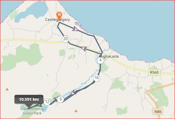
Castlegregory- Low Road- Seven Hogs-Glanteenassig Forest Park-Arglen- Castlegregory
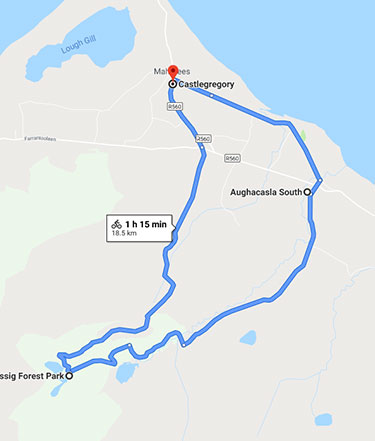
Or take this easier route
Plot My route:- https://www.plotaroute.com/route/1481302
Distance:- 18.7km/21.18km
Ascent:- 357 m
Time:- 1 hr.15 minutes
Grade:- Moderate
 Leaving Castlegregory take the “Low Road to Aughacasla and the head up to Glanteenassig Forest park. Enjoy the views, Stop off at Lough Slat before heading to the top lake of Lough Caum. Take a walk around the lake, have a picnic, listen to nature before heading back down the hill via alternate route as in map. This will bring you to dirt roads seldom used by cars so you will have it all to yourself. You will meet up with the main road again. Cross here on to main road again back to Castlegregory. A great cycle full of promise and a great way to get the Kerry air into the lungs.
More Cycling Routes
[intense_menu type=”horizontal” mode=”desktop_only” name=”Cycling” top_font_color=”#357dae” top_hover_font_color=”#205b85″ top_active_background_color=”#7ea9cc”]