Mount Brandon Walking Route,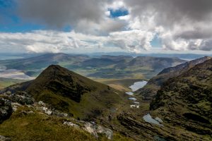
Click on this link for google maps directions.
(Car parking is available at Faha)
Distance :-14.5km
Time 4 hours depending on route
Start:- Faha Car Park
Finish:- Faha Car Park
Ascent: 953m
When to go: All year round
Nearest Services: Cloghane
Car Parking:- Faha Car Park
Ordnance Survey Map No: 70
 23 minute drive to Faha from Castlegregory brings you to the car park at Faha. This strenuous walk offers a dramatic ascent up through the glaciated valley with it’s series of paternoster lakes and the sheer valley walls carved out by ice in the long ago. A short scramble at the back of the valley brings you onto the col and the onwards for a ten minute walk from the summit.
Other walks around Brandon Include:-
1- Brandon Range Walk :- If you’re feeling extra energetic, the Brandon Range Walk is ideal. The 6.5hr (15km) route is considered one of the most beautiful hiking routes in Ireland, but it definitely requires stamina. The route covers the main peaks of the Brandon Mountain range, including Gearhane Mountain, Brandon Peak and Mount Brandon.
2- The Saints’ Road:- The Saints’ Road is the quickest and easiest route up Mount Brandon. The route starts at the car park in Baile Breac and it’s marked along the way by large stone crosses. The ascent is mostly up grassy, boggy slopes before it gets steeper and turns rocky near the top. On a sunny day, the views from the mountain are spectacular.
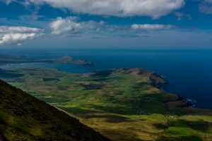
3- Más an Tiompáin Walking Route:- Más an Tiompáin or Masatiompan (763m) is a moderate to strenuous 12.5km (4 hour) walking route from Teer, just outside the coastal village of Cloghane at the foothill of the Brandon Mountains and on the Wild Atlantic Way scenic driving route, Co. Kerry, Ireland. In Irish it means ‘rump of the drum/hump/hollow’ which suits this lovely rounded mountain.
4- Brandon Mountain -Ballysitteragh – Conor Pass:- This is a tough walk first going up to Brandon Mountain walking along the top of mountain until you reach the peak. Follow trail down into Ballysitteragh and finish up in Connor pass.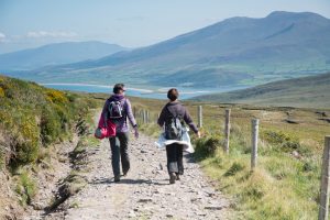
NB:-Great care is require on all these walks and careful planning is advisable. Use the available recourses that are online and Ordnance Survey Maps are essential.